
Map options
Rambler-Webs Mapping option - changes
|
The mapping options on all our Joomla sites have been updated. This affects the types of map that can be displayed as the background. The reason for this change is because Bing (or Microsoft who run Bing) are withdrawing their current mapping options, later this year, and changing to a facility called Azure. Azure does not provide the same options as Bing. |

Old options
|
The option Ordnance Survey displayed the OS Explorer and Landranger style maps (25K and 50K) as many walkers use these, especially in their paper form. We have now changed the name of this option to Bing Ordnance Survey. |
 In the past we had five mapping styles that could be displayed. The first two are supplied by Open Street Map and the last three by Bing/Microsoft.
OS Landranger and Explorer maps
 |
 |
| 25K Explorer Map example | 50K Landranger Map example |
These maps are used by many and we have had requests in the past to make them the default map. This was not possible because of licensing costs.
New Options
|
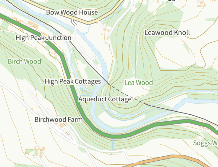
and two new options added o Aerial View, Esri o Ordnance Survey |
 Our new software has three changes.
The Aerial View, Esri is a satellite view similar to the Bing Aerial option.
|
However this style of map does not replace the 25K/50K maps, as it does not show many footpaths and does not indicate Rights of Way. It does however o provide a good display of the contours of the landscape Note: the Walks Manager has an Ordnance Survey option, the map used is similar to our version but uses different styling. |
Future
The Bing facility is being withdrawn this year and in July our software will stop displaying the three Bing options. This means we will no longer have access to the Bing Aerial views and the Bing Ordnance Survey, 25K and 50K style, maps.
The new Ersi option provides an alternative satellite view which I hope will fill that role.
In looking to replace the Bing Ordnance Survey option we have had to turn to Ordnance Survey themselves. Unfortunately while OS do still provide these map styles they have not found a way for us to use them with our other map options. For technical reasons it is not possible to display them directly from OS along side our other maps and it is too expensive to only use these maps. I will not describe the technical issues as that would take awhile. Contact me if you are interested.
I am in discussion with OS on what can be done but so far there is no solution. I am hopeful that in the future our new Ordnance Survey style could contain footpath/rights of way information. If this happens then we would be able to display footpaths/RoW on these maps. I will maintain contact with OS and hopefully be able to encourage them in this direction.
Chris Vaughan
Request: for those of you with a technical bent it would be useful to hear from anyone who has experience in styling either Open Street Map or Ordnance Survey maps and in particular vector tiles.